ODP Legacy > Scientific Results > Leg Summaries > Leg 207 >
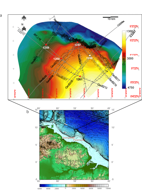
A) sites cored and logged (red) and cored only (white), bathymetry and pre-cruise and cruise-acquired seismic lines; B) Location map showing the operational area on Demerara Rise.
Program administration |
Scientific results |
Engineering & science operations |
Samples, data, & publications |
Outreach |
Overview |
Site map |
Search |
Home
For comments or questions, please contact webmaster@iodp.tamu.edu.
Copyright Consortium for Ocean Leadership