ODP Legacy > Scientific Results > Leg Summaries > Leg 188 >
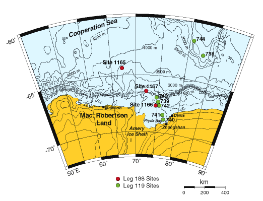
Map of the East Antarctic coastline showing the location of Prydz Bay and the sites drilled during Leg 188 and previously during Leg 119 (Barron, Larson, et al., 1989).
Program administration |
Scientific results |
Engineering & science operations |
Samples, data, & publications |
Outreach |
Overview |
Site map |
Search |
Home
For comments or questions, please contact webmaster@iodp.tamu.edu.
Copyright Consortium for Ocean Leadership