ODP Legacy > Scientific Results > Leg Summaries > Leg 193 >
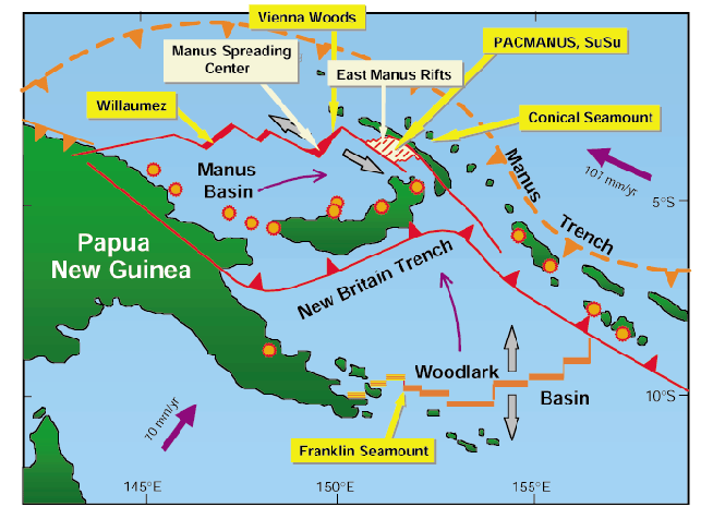
Regional tectonic map setting of the PACMANUS site drilled during Leg 193. The Manus Basin occupies a back-arc position relative to the present day subduction along the New Britain Trench to its south. Creation of new oceanic crust occurs at the Manus Spreading Center and at smaller segments to its west. Major transform faults are somewhat oblique to the spreading segments. Active volcanoes of the Bismarck arc are indicated (red/orange circles). Yellow boxes refer to known hydrothermal sites. Plate motions are shown as thick blue arrows. Curved blue arrows denote the sense of rotation on microplates as defined by GPS geodesy (Tregoning et al., 1998) or by opening and westward propagation of the Woodlark Basin (Taylor et al., 1995).
Program administration |
Scientific results |
Engineering & science operations |
Samples, data, & publications |
Outreach |
Overview |
Site map |
Search |
Home
For comments or questions, please contact webmaster@iodp.tamu.edu.
Copyright Consortium for Ocean Leadership